5 Questions with June Wang: A Statewide Tool to Track Wildfire Risk

By Mike Nolan
ALBANY, N.Y. (Nov. 21, 2024) — With areas stretching from the Adirondacks to Long Island at high risk of fire danger this month, researchers at the University at Albany have been hard at work to help keep New Yorkers safe.
In October, Governor Hochul announced a new weather data tool to inform New Yorkers when there is an increased risk of wildfires. The tool, a partnership between the New York State Mesonet and the state Department of Environmental Conservation (DEC), utilizes data from the Mesonet’s weather network to generate daily fire danger ratings.
The NYS Mesonet, operated by UAlbany, features 127 standard weather observation stations that cover the entire state. Each site measures a variety of weather conditions in real time including temperature, humidity, wind speed and direction, pressure, precipitation, solar radiation, snow depth and soil information, and offers camera images.
NYS Mesonet data, updated every five minutes, is being used to support the DEC’s daily fire danger map. The map divides New York into multiple fire danger rating areas and then rates each on a wildfire risk scale from low to extreme.
We caught up with NYS Mesonet Director June Wang to learn more about the new tool and how it is improving public safety.
How is Mesonet data improving the daily fire danger ratings issued by the DEC?
We are partnering with the DEC to monitor data from 48 of our weather stations. This enhanced data collection helps to track the local variability of fire danger across the state, allowing community leaders, emergency managers and everyday New Yorkers to adapt their activities to prevent fires and reduce damage.
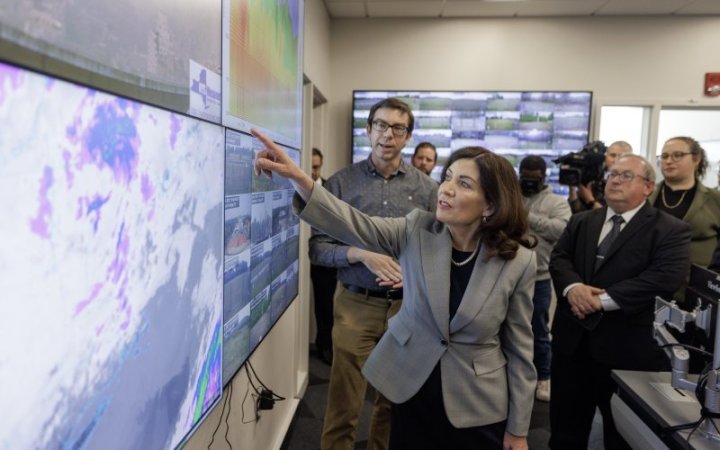
An internal dashboard has been built to automatically display maps of NYS Mesonet data, along with outputs from the Weather Information Management System (WIMS) and Fire Danger Rating Areas (FDRA), allowing the DEC to manually modify risks and publish the final fire danger map on their website each day.
The Mesonet team has also developed a website that publishes current and historical maps, information on fire risk across the state, as well as real-time camera images for situational awareness.
What conditions are most important to monitor when determining wildfire danger?
Wildfire danger is influenced by a combination of weather, fuel conditions and human activity. Key weather conditions to monitor include temperature, as higher temperatures dry out vegetation (grasses, shrubs and trees), making it more flammable, and relative humidity, since low humidity increases the likelihood of vegetation igniting. Wind speed and direction are also important, as strong winds can rapidly spread flames. Precipitation plays a role as well, with prolonged dry periods or droughts significantly increasing wildfire risk.
Our Mesonet stations track all of these weather conditions in real time. We have at least one standard station located in each of New York’s 62 counties, spaced an average of 17 miles apart.
Why are wildfires becoming more prevalent in the Northeast?
The changing climate is playing a significant role. Wildfire risk increases with above normal temperatures, longer and severe drought conditions, a drier atmosphere and drier vegetation. As the climate gets warmer, we expect more extreme and rarer severe weather events, such as wildfires in the Northeast. Past studies have also found that the frequency and severity of fire weather has increased in recent decades and is projected to escalate with each added increment of warming.
Check out this loop courtesy of the @NYSMesonet
of the ETEC building in Albany from today. You can see the smoke from the Catskills wildfire rolling in around 10am. Notice how the visibility of the Helderbergs and buildings in the background changes once the smoke arrives. #nywx pic.twitter.com/teg2N2sXQc— NWS Albany (@NWSAlbany) November 10, 2024
Transported wildfire smoke is also an issue. A 2022 study led by our Mesonet team found that more frequent and intense wildfires in the western U.S. and southern Canada are not only impacting air quality in surrounding areas, but also as far as the East Coast. New York City recorded its worst-ever air quality day in June 2023 due to transported Canadian wildfire smoke. At its peak, the Air Quality Index (AQI) for the city reached 405 out of 500.
The Mesonet has a specialized network of 17 profiler sites, each equipped with a Doppler LiDAR and a microwave radiometer that scan the atmosphere and can track transported wildfire smoke.
What tips do you have for people to stay safe during wildfire season?
People should be aware that there’s a real risk of fire danger in New York and that as our climate continues to warm wildfires may become more prevalent.
It’s important that New Yorkers follow the daily fire danger map and alerts issued by the DEC. There is currently a statewide burn ban until Nov. 30. This burn ban prohibits the starting of outdoor fires statewide for purposes of brush and debris disposal, as well as uncontained campfires and open fires used for cooking.
More information on fire safety and prevention is available on the DEC website.
Where can New Yorkers find more information about the fire danger ratings?
The DEC Fire Danger Map offers daily updates on fire danger risk levels across the state.
A public website hosted by the NYS Mesonet offers current and historical fire weather information, updated daily.


